This website uses cookies

Imprint | Data Protection Notice

This website uses cookies and similar functions to process end device information and personal data. The processing serves the statistical analysis/measurement. Your consent is always voluntary, not required for the use of our website and can be rejected or revoked at any time on our site.

Open in Fullscreen

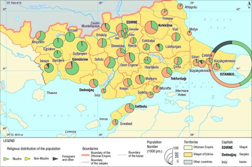
Map 44 : Religious distribution of the population in Edirne Vilayet, cca. 1881

BV047665256
- Image is not present for this map. You can contact us under geoportost@ios-regensburg.de for more information.
Full Title
Map 44 : Religious distribution of the population in Edirne Vilayet, cca. 1881
Publication Place
Languages
Scale
4136154
Publication years
2021 — 2022
Depicted years
1881 — 1882

Context

Details

Tools